 Overview
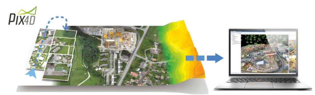
Pix4D makes software solutions for professional drone-based mapping, purely from Images. We believe work should be a space of creation, not endless routine.
Our team knows what it’s like to fly drones every day and feel amazed by maps made from images. We want to share that with you by providing the best possible tools for more exciting abnd efficient work.
Developed in 2011 from years of scientific research, Pix4D software uses images taken by hand, drone, or plane and creates customizable results that compliment a wide range of applications and software. Pix4Dbim, Pix4model, Pix4Dag or Pix4mapper Pro solutions are meant to be tailored to any industry or workflow on mobile, desktop and could platforms. Produce precise and georeferenced maps, mosaics, and 3D models.